
Tropical storm and storm surge warnings in place for all of OBX, evacuation order issued for four-wheel drive area north of Corolla
- Corinne Saunders

- Aug 20, 2025
- 4 min read
Updated: Aug 23, 2025

Atlantic Ocean overwash flows across N.C. Highway 12 at the north end of Buxton on Hatteras Island in Dare County on the afternoon of Tuesday, Aug. 19, 2025, after high tide. (Screenshot of DriveNC.gov camera view)
By Corinne Saunders
Sections of Hatteras Island began experiencing overwash from still-distant Hurricane Erin on Tuesday, and all of the Outer Banks is under a tropical storm warning and a storm surge warning.
The Outer Banks is expected to see the greatest impacts from this long-duration event Wednesday evening through Thursday.
“Coastal flooding, storm surge, and overwash has already begun and will worsen through today, peaking tonight into Thursday,” according to Wednesday’s 5 a.m. forecast from the U.S. National Weather Service at Newport/Morehead City.
The storm surge warning prediction is 2-4 feet of inundation above normally dry ground, with the highest water levels anticipated for oceanside areas late Wednesday through Friday.
Currituck County declared a local state of emergency and issued a mandatory evacuation for the four-wheel drive area north of Corolla late Tuesday.
“The beach strand driving area, which is the only way in and out of the off-road area for motorists, is expected to become impassable by Thursday afternoon,” the county press release said. “Localized flooding is expected in the neighborhoods behind the dunes.”
Earlier in the day, Currituck County had sent an advisement for visitors to leave the four-wheel drive area.
The mandatory evacuation applies to everyone and is effective at 9 a.m. on Wednesday.
Anyone in need of evacuation assistance should call Currituck County Emergency Management at 252-232-2115, according to the press release said.
Dare and Hyde counties on Sunday each declared a state of emergency and issued mandatory evacuations of Hatteras Island and Ocracoke Island, respectively.
Hyde County on Tuesday announced the opening of a pet-friendly hurricane shelter that can accommodate up to 400 people. The shelter is located at Warren County Parks and Recreation at 113 Wilcox Street in Warrenton. People going to the shelter are asked to take up to a week’s worth of clothing and medicine.
Dare County announced Tuesday afternoon that due to ocean overwash concerns, the Dare County Water Department will shut off water to an area located south of N.C. Highway 12 and along Old Lighthouse Road in Buxton by 5 p.m. on Wednesday. Affected customers have been notified.
Dare County officials encouraged anyone on Hatteras Island not yet evacuated to do so promptly.
“Once coastal flooding begins, inundation will persist for several days, worsening with each high tide,” the county’s Tuesday bulletin announced. “N.C. Highway 12 is expected to become impassable, making it extremely difficult—if not impossible—for emergency services personnel to respond to calls for service.”
The North Carolina Department of Transportation Ferry Division announced that it is suspending ferry operations to and from Ocracoke Island Wednesday until further notice, due to Hurricane Erin. The last scheduled departures from Swan Quarter to Ocracoke and from Cedar Island to Ocracoke are set for 10:30 a.m., and the final departure from Ocracoke to Swan Quarter is at 11 a.m.
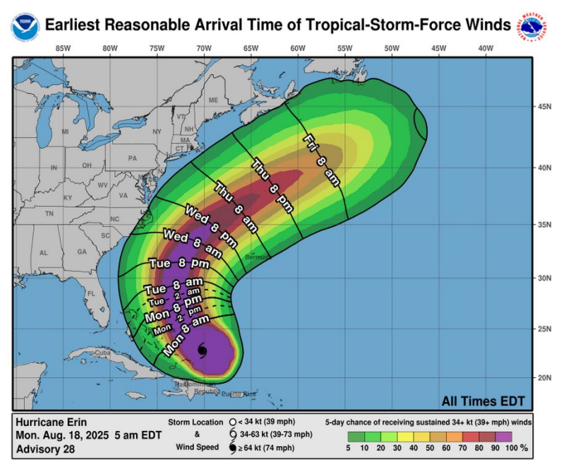
Hurricane Erin, currently a strong Category 2 hurricane with maximum sustained winds of 100 mph, is forecast to move north on Wednesday, and then northeast on Thursday.
The storm is predicted to increase in size, with tropical storm force winds reaching the Outer Banks Wednesday evening and lasting through Thursday. Waves of 15-20 feet are expected in the surf zone.
“Despite the path of Erin forecast to remain offshore, the threat for life-threatening rip currents, damaging beach erosion, major inundation and overwash and extremely dangerous surf is expected,” the U.S. National Weather Service at Newport/Morehead City briefing said.

North Carolina Department of Transportation workers move sand off N.C. Highway 12 and work to rebuild the dunes on the north end of Hatteras Island after the morning high tide pushed higher by Hurricane Erin affected the area on Wednesday, Aug. 20, 2025. (Screenshot of DriveNC.gov camera view)
Further details
The U.S. National Weather Service at Newport/Morehead City will provide twice-daily hurricane updates through Thursday. For the most current local weather information for Dare County and south, visit its website or Facebook page.
The U.S. National Weather Service at Wakefield, Virginia, covers Currituck County, including Corolla and north. For more information about that area, visit its website or Facebook page.
The National Hurricane Center website is https://www.nhc.noaa.gov.
To sign up for Dare County-specific severe weather updates and for any other official messaging of interest, visit the OBX Alerts website.
To sign up for Currituck County-specific updates through Currituck Alert, text CTUCKALERT to 888-777. For alerts specific to Corolla and the 4WD beaches, text SAFECOROLLA to 888-777.
--------
Editor’s Note: Did you appreciate Outer Banks Insider’s ad-free local news? Subscribe today at this link to access all our in-depth, exclusive reporting and to sustain community focused independent news in the area you love.
Comments